Home
Location
Safe Harbor
World Class Fishing
Property Details
Opportunities
Sale Details
Photo Gallery
Title
Contact Us
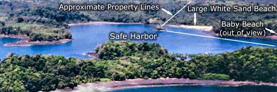
Isla Parida is part of the National Park system and one of very few islands that can be inhabited and privately owned. Its peak elevation is 800’ and has a dense forest of old growth hardwood trees. Approaching the island by boat, the depth within 500’ of land averages 9’ but can be as shallow s 4’. There are white sand beaches encircling the island and the west side has a large bay that is sheltered from Pacific storms by another offshore island, Paradita. It is here within the old pirate cove that the best mooring sites exist. It is here you will find this 130-acre parcel. With a depth of 10’ plus and blocked from the swell and onshore winds, the bay is capable of holding nearly 40 yachts on anchor. A small hat shaped island 100’ from this parcel’s white sand beach could be used to station a pier that extended all the way to shore by concession application.
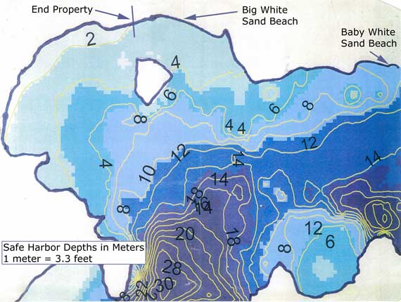
Safe Harbor depth chart, depths in meters.
See the Photo Gallery for more images!